


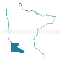
Brown, Lyon, Redwood, Chippewa, Yellow Medicine, Lac qui Parle & Lincoln Counties PUMA, Minnesota
About
Outline

Summary
| Unique Area Identifier | 193244 |
| Name | Brown, Lyon, Redwood, Chippewa, Yellow Medicine, Lac qui Parle & Lincoln Counties PUMA |
| State | Minnesota |
| Area (square miles) | 4,899.33 |
| Land Area (square miles) | 4,846.22 |
| Water Area (square miles) | 53.11 |
| % of Land Area | 98.92 |
| % of Water Area | 1.08 |
| Latitude of the Internal Point | 44.60988730 |
| Longtitude of the Internal Point | -95.66428530 |
Maps

Graphs
Select a template below for downloading or customizing gragh for Brown, Lyon, Redwood, Chippewa, Yellow Medicine, Lac qui Parle & Lincoln Counties PUMA, Minnesota


Neighbors
Neighoring Public Use Microdata Area (by Name) Neighboring Public Use Microdata Area on the Map
- Blue Earth, Nicollet & Waseca Counties--Mankato City PUMA, MN
- Jackrabbit Region PUMA, SD
- Kandiyohi, McLeod, Meeker, Renville & Sibley Counties PUMA, MN
- Northeast South Dakota PUMA, SD
- Southwest Minnesota PUMA, MN
- West Central Minnesota PUMA, MN
Top 10 Neighboring County (by Population) Neighboring County on the Map
- Blue Earth County, MN (64,013)
- Kandiyohi County, MN (42,239)
- Nicollet County, MN (32,727)
- Brookings County, SD (31,965)
- Brown County, MN (25,893)
- Lyon County, MN (25,857)
- Redwood County, MN (16,059)
- Renville County, MN (15,730)
- Chippewa County, MN (12,441)
- Cottonwood County, MN (11,687)
Top 10 Neighboring County Subdivision (by Population) Neighboring County Subdivision on the Map
- Marshall city, Lyon County, MN (13,680)
- New Ulm city, Brown County, MN (13,522)
- Montevideo city, Chippewa County, MN (5,383)
- Redwood Falls city, Redwood County, MN (5,254)
- Sleepy Eye city, Brown County, MN (3,599)
- Tracy city, Lyon County, MN (2,163)
- Springfield city, Brown County, MN (2,152)
- Granite Falls city, Yellow Medicine County, MN (2,044)
- Ortonville township, Big Stone County, MN (2,011)
- Canby city, Yellow Medicine County, MN (1,795)
Top 10 Neighboring Place (by Population) Neighboring Place on the Map
- Marshall city, MN (13,680)
- New Ulm city, MN (13,522)
- Montevideo city, MN (5,383)
- Redwood Falls city, MN (5,254)
- Sleepy Eye city, MN (3,599)
- Granite Falls city, MN (2,897)
- Tracy city, MN (2,163)
- Springfield city, MN (2,152)
- Canby city, MN (1,795)
- Madison city, MN (1,551)
Top 10 Neighboring Unified School District (by Population) Neighboring Unified School District on the Map
- New Ulm Public School District, MN (19,228)
- Marshall Public School District, MN (15,742)
- Redwood Area School District, MN (8,322)
- Pipestone Area School District, MN (7,718)
- Montevideo Public School District, MN (7,599)
- Yellow Medicine East School District, MN (7,006)
- St. James Public School District, MN (6,620)
- Lac Qui Parle Valley School District, MN (6,541)
- GFW Schools, MN (6,148)
- Lake Crystal-Wellcome Memorial School District, MN (6,121)
Top 10 Neighboring State Legislative District Lower Chamber (by Population) Neighboring State Legislative District Lower Chamber on the Map
- State House District 23A, MN (39,401)
- State House District 13B, MN (37,827)
- State House District 21A, MN (36,793)
- State House District 22B, MN (36,558)
- State House District 24B, MN (36,327)
- State House District 21B, MN (35,392)
- State House District 22A, MN (34,781)
- State House District 20B, MN (34,629)
- State House District 20A, MN (32,187)
- State House District 4, SD (20,558)
Top 10 Neighboring State Legislative District Upper Chamber (by Population) Neighboring State Legislative District Upper Chamber on the Map
- State Senate District 23, MN (82,921)
- State Senate District 13, MN (76,590)
- State Senate District 21, MN (72,185)
- State Senate District 22, MN (71,339)
- State Senate District 24, MN (71,152)
- State Senate District 20, MN (66,816)
- State Senate District 4, SD (20,558)
Top 10 Neighboring 111th Congressional District (by Population) Neighboring 111th Congressional District on the Map
- Congressional District (at Large), SD (814,180)
- Congressional District 1, MN (644,787)
- Congressional District 7, MN (625,512)
Top 10 Neighboring Census Tract (by Population) Neighboring Census Tract on the Map
- Census Tract 9506, Chippewa County, MN (5,908)
- Census Tract 3603, Lyon County, MN (5,275)
- Census Tract 9531, Grant County, SD (5,239)
- Census Tract 7806, Kandiyohi County, MN (5,097)
- Census Tract 9602, Brown County, MN (4,482)
- Census Tract 9604, Brown County, MN (4,479)
- Census Tract 3605, Lyon County, MN (4,387)
- Census Tract 3604, Lyon County, MN (4,095)
- Census Tract 9605, Brown County, MN (3,832)
- Census Tract 9586, Brookings County, SD (3,746)
Top 10 Neighboring 5-Digit ZIP Code Tabulation Area (by Population) Neighboring 5-Digit ZIP Code Tabulation Area on the Map
- 56073, MN (16,759)
- 56258, MN (15,617)
- 56265, MN (7,757)
- 56283, MN (6,636)
- 56081, MN (6,098)
- 56164, MN (5,969)
- 56085, MN (5,451)
- 57252, SD (4,800)
- 56215, MN (4,693)
- 56241, MN (4,166)